
The Ultimate Guide to Rochester, NY Neighborhoods
The Short Version
- Rochester is not a city you understand from the highway — it is a place built neighborhood by neighborhood, each with its own identity and unwritten rules.
- This is the definitive guide: Part One covers city neighborhoods, Part Two covers the suburbs, and a final section helps you figure out which one fits you.
- The guide starts with what Rochester chose and what it lost after World War II — because you cannot understand the neighborhoods without understanding the highway decisions that shaped them.
- Rochester has a population of about 207,000, making it the third-largest city in New York — but it has always felt smaller than that number suggests, and that is not a flaw.
- Whether you are moving to Rochester, visiting, or have lived here for decades, this guide will change how you see the place.
Rochester is not a city you understand from the highway. You understand it from the porch.
This is a place built neighborhood by neighborhood, block by block, front yard by front yard. A city where people still know their neighbors' names, argue passionately about which garbage plate is the best, and stay put for decades in houses their grandparents warned them would be "too much work." Rochester has a population of approximately 207,282 people, making it the third-largest city in New York State and the tenth most populated in the state overall — but it has always felt smaller than that number suggests, and that is not a flaw (U.S. Census Bureau, Population Estimates Program, 2024).
What makes Rochester feel like a collection of towns rather than one sprawling urban mass is the same thing that makes it worth understanding carefully: its neighborhoods are genuinely distinct from one another. They have their own identities, their own rhythms, their own unwritten rules about how loud you can play music on a Tuesday.
But to understand Rochester's neighborhoods today, you need to understand what the city chose — and what it lost — in the decades after World War II.
A City That Broke Itself, and Is Putting Itself Back Together

A City That Broke Itself, and Is Putting Itself Back Together
Underneath the stretch of I-490 that rings downtown Rochester lies one of the most poignant urban histories in the region. The right-of-way that the expressway now occupies has lived three separate lives, each one a little less hospitable to human connection than the last.
The first life was as the Erie Canal. Completed through Rochester in 1823, the canal was the economic spine of the young city, carrying commerce and people in both directions and generating the wealth that built the grand houses you can still see on East Avenue today. Canal boats moved through the city's neighborhoods, with locks and wharves creating natural gathering points. The last boat navigated the Erie Canal through downtown Rochester in 1919, when the canal was rerouted to bypass the city (Rochester & Genesee Valley Railroad Museum).

The second life was as the Rochester Subway. After the city purchased the abandoned canal bed in 1919, planners chose — remarkably — to build a light rail line rather than an automobile highway. At the time, there were only 3,600 cars in all of Monroe County, and civic leaders thought a future requiring dedicated car roads was "unrealistic." The Rochester Industrial and Rapid Transit Railway opened in December 1927, its red-and-cream trolley cars running seven miles through the city with more than twenty stops, connecting neighborhoods from the west side General Motors plant all the way to the Rowlands Station near Monroe Avenue and Westfall Road. The system served the Park Avenue and Monroe Avenue corridors directly. The total construction cost was $12 million — roughly $165 million in today's dollars (Rochester & Genesee Valley Railroad Museum).
The subway operated until June 30, 1956 — the last day of trolley operation in all of New York State outside New York City. What ended it was not lack of ridership alone, but a decision by the New York State government to use the same right-of-way for a new expressway connecting Rochester to the Thruway. The city council voted to end subway service in 1955. The highway that replaced it did not connect neighborhoods — it encircled and divided them.

The Inner Loop, as it became known, was the most visible expression of this era's planning philosophy. Constructed between 1952 and 1965, the expressway system demolished over 1,300 homes and businesses across the city, carving a moat around downtown that physically and psychologically separated the urban core from the neighborhoods that surrounded it. Corn Hill felt it acutely. So did the communities along what is now I-490. The highway that replaced the subway behind Harvard Street in the ABC Streets neighborhood is the same right-of-way that had previously been a trolley line, which had previously been the Erie Canal. Three layers of transportation history, each one progressively more hostile to the idea of neighbors encountering each other by chance (Segregation by Design, Rochester NY).
The good news — and there is genuine good news here — is that Rochester has spent the last decade doing something rare among American cities: actually reversing the damage. The eastern section of the Inner Loop was filled in between 2014 and 2017, replacing sunken highway with surface streets and new development. The New York Times praised the project in 2021 as a model for removing urban highways. In January 2025, the U.S. Department of Transportation awarded Rochester $100 million through the Reconnecting Communities Pilot Program — one of the largest grants in the program's history — to remove the northern section of the Inner Loop, converting 1.5 miles of expressway into a surface boulevard and creating approximately 22 acres of new land for housing and green space, with construction expected to begin in 2027 (Wikipedia, Inner Loop Rochester, 2025).
Rochester broke something important in the postwar decades. It is now, deliberately and expensively, trying to fix it. That context matters as you read about its neighborhoods — because the best ones are the ones that survived that era with their character intact, and the most exciting ones are the ones that are thriving precisely because the damage is finally being undone.
How to Use This Guide

How to Use This Guide
Rochester's city neighborhoods are organized roughly by the city's four quadrants — southeast, southwest, northeast, and northwest — plus downtown. For this guide, we've grouped them by character and geography rather than bureaucratic boundary, because that's how Rochesterians actually think about them.
The suburbs are covered in the second half of the guide with full profiles, because the Rochester experience extends well beyond the city line and the suburbs are genuinely distinct from one another in ways that matter if you're choosing where to land.
A note on the Block philosophy that informs this guide: every neighborhood here is described not just by its demographics or its median home price, but by what it offers as a place to belong. The question worth asking about any neighborhood is not just "can I afford it?" but "will I be invited in?"
Part One: City Neighborhoods

Part One: City Neighborhoods
Downtown / Center City
Downtown Rochester is the economic and cultural hub of a metropolitan area of more than 1.09 million people, and it is in the middle of the most significant transformation it has seen in generations (U.S. Census Bureau, Rochester Metropolitan Statistical Area, 2020).
The skyline is anchored by the Genesee River, which cuts through the city from south to north before emptying into Lake Ontario. High Falls — a 96-foot waterfall in the heart of the city — remains one of Rochester's most underappreciated assets, a genuinely dramatic natural feature tucked into what was once a heavy industrial district and is now an emerging neighborhood in its own right.
The Strong National Museum of Play, a well visited museum with national attention, sits just southeast of the central business district and draws families from across the region. The Blue Cross Arena, Frontier Field (home of the Rochester Red Wings, Triple-A affiliate of the Washington Nationals), and the Joseph A. Floreano Rochester Riverside Convention Center make downtown a genuine destination for events. The Eastman School of Music — one of the world's great conservatories, founded by George Eastman — anchors the East End entertainment district along Gibbs Street, where restaurants and bars cluster around frequent performances.

Rochester's cost of living index sits at 101.7, essentially at the national average, which is remarkable for a city with this concentration of cultural amenities (City-Data.com, 2024). The poverty rate within the city is 25.5%, a number that reflects deep structural inequities that the Inner Loop removal and associated reinvestment programs are specifically designed to address (U.S. Census Bureau, American Community Survey 5-Year Estimates, 2023).
The Cascade District — a former industrial area along the Genesee — has become one of downtown's most distinct emerging neighborhoods, with adaptive reuse of old structures and the Corn Hill Arts Festival as an annual anchor.
Park Avenue
If you want to understand why people fall in love with Rochester and never leave, start on Park Avenue on a Saturday morning in late May.
The street hums. Coffee shops spill onto sidewalks. The farmers market draws the whole neighborhood out of doors. Cyclists and dog walkers and stroller-pushing parents navigate around each other with the easy negotiation of people who have done this many times before. The lilacs — Rochester is the Lilac Capital of North America, and the Lilac Festival in Highland Park draws over 500,000 visitors each year — are just finishing their bloom.
Park Avenue is one of the most desirable neighborhoods in all of Rochester, and it has been for a long time. The Park Avenue Historic District was listed on the National Register of Historic Places in 2020, recognizing the architectural integrity of the housing stock — predominantly early 20th century homes in a range of styles, from craftsman bungalows to brick Colonials — and the neighborhood's role in Rochester's development (Wikipedia, Rochester New York, 2025).
The commercial district anchors around two distinct nodes. Near Berkeley Street, a tight cluster of restaurants, coffee shops, and boutiques creates a village-square feeling in the middle of the city. Further east toward Goodman Street, a second commercial stretch offers more options in a slightly less precious atmosphere. Between these two poles runs a long residential spine of tree-lined streets with housing that would cost three times as much in almost any comparable northeastern city.

The neighborhood is walkable to Cobbs Hill Park — 109 acres of green space with a reservoir, walking trails through Washington Grove (an old-growth forest), athletic courts, and some of the best skyline views in the city. The bus line runs along Park Avenue itself, making car-free living genuinely viable.
Park Ave skews toward young professionals and empty nesters. It is not a cheap neighborhood by Rochester standards — median home prices in the broader Park Avenue area historically run double the citywide median of approximately $75,000 — but it remains extraordinarily affordable by the standards of comparable northeastern urban neighborhoods. The city's annual Pride Parade is hosted here, a tradition that speaks to the neighborhood's inclusive character (Wikipedia, Rochester New York, 2025).
I lived here for six years, just a block off Park Avenue between Park and East. I also grew up in the neighborhood, in the ABC Streets, until I was twelve. It is the kind of place that gets under your skin because it rewards walking — every walk reveals something new, some garden you hadn't noticed, some porch conversation you didn't mean to overhear, some restaurant that just opened where the dry cleaner used to be.
The ABC Streets
Tucked between Park Avenue to the north, Harvard St to the south, Culver Road to the west, and Colby Street to the east is one of Rochester's most quietly beloved neighborhoods — the ABC Streets.
The name comes from the eight cross streets that run through the neighborhood in alphabetical order: Audubon, Beverly, Calumet, Darwin, Ericsson, Faraday, Girard, and Homer. Each street is named for a famous scientist, naturalist, or explorer — Charles Darwin, Michael Faraday the physicist, John James Audubon the ornithologist — giving the whole neighborhood an Enlightenment-era flavor that feels entirely appropriate for a city built on invention (ABC Streets Neighborhood Association).
The neighborhood comprises approximately 600 households — a mix of owners and renters, young professionals and longtime residents, families with small children and empty nesters who have been on the same block for thirty years. The housing stock is predominantly early 20th century, and the streets are genuinely beautiful: wide, tree-lined, with houses set back behind deep front yards and welcoming porches.
The ABC Streets sit within the Park Avenue Historic District and are within easy walking distance of the George Eastman Museum, the Memorial Art Gallery, the Rochester Museum and Science Center, and the commercial stretches of both Park Avenue and East Avenue. Cobbs Hill Park is accessible on foot. The neighborhood is exceptionally well-positioned within the city's geography — close to almost everything worth being close to, while maintaining a residential quiet that the commercial streets nearby do not.
The neighborhood has its own resident association that has been active for more than forty years. It organizes events, advocates for the neighborhood's interests, and has helped transform Morrison Park — a small triangular green space at the corner of Culver, Canterbury, and Harvard Streets — into a genuine community gathering place.
There is a remarkable layering of history beneath the ABC Streets that is worth knowing. Harvard Street, which forms the neighborhood's southern boundary, sits directly above what was once the Erie Canal, then the Rochester Subway trolley line, and is now the I-490 expressway. Three successive transportation infrastructures, each representing a different theory of how cities should move people — and each one less community-serving than the last. The neighborhood itself organized in the 1980s specifically in response to the noise and disruption from I-490 reconstruction, which gives the residents a particular historical awareness of what infrastructure decisions can do to a neighborhood's character (ABC Streets Neighborhood Association, History).
One more detail, because every neighborhood guide should have at least one genuinely strange historical footnote: George Eastman's personal physician lived in the ABC Streets and was known to walk his pet cheetah on a leash through the neighborhood. This happened. It is documented. Rochester contained multitudes.
South Wedge
The South Wedge is what happens when a neighborhood decides to be itself so thoroughly that it becomes something everyone wants a piece of.

Wedge-shaped — hence the name — the neighborhood is bounded by the Genesee River on the west, I-490 on the north and east, and it centers on South Avenue, one of Rochester's most interesting commercial streets. The South Wedge Historic District was listed on the National Register of Historic Places in 2013, reflecting a housing stock dominated by Colonial Revival and Craftsman homes, many dating from the mid-1800s through the early 1900s (Wikipedia, Rochester New York, 2025).
With a population of approximately 22,866 and a median age of just 33, the South Wedge is one of the youngest neighborhoods in the city (Point2Homes, American Community Survey 5-Year Estimates, 2023). This is young-professional and young-family territory — people who want urban density, neighborhood character, proximity to Highland Hospital and the University of Rochester Medical Center, and a lively commercial strip with more bars than Park Avenue and more edge than Browncroft.
The vibe skews crunchy, in the best possible way. Locally-owned restaurants, independent coffee shops, a farmers market on Gregory Avenue, community gardens, and a strong network of block clubs and neighborhood associations. The South Wedge Planning Committee has been active since 1973 — one of the oldest neighborhood advocacy organizations in the city — and it shows in the care taken with the public realm (Wikipedia, Rochester New York, 2025).
Frederick Douglass lived in the South Wedge, publishing the abolitionist newspaper The North Star from a house in the neighborhood. That history of principled, community-rooted activism is not coincidental to the neighborhood's current character.
Median home prices in the South Wedge run around $225,500, with homes typically selling in just 16 days — well below the national average of 55 days, reflecting genuine demand (Homes.com, 2024). For the price, you get a walkable urban neighborhood with strong community identity, easy access to major employers, and the Genesee River gorge as a backyard. It is very hard to beat.
Pearl-Meigs-Monroe (The Garden District)
Between I-490 and Monroe Avenue, from Alexander Street to South Goodman, lies a neighborhood that locals have taken to calling the Garden District — and the name fits in more ways than one.
Pearl-Meigs-Monroe, named for its three main roads, is the most walkable neighborhood in all of Rochester, with a Walk Score of 92 (Walk Score, 2024). It is dense, renter-heavy (about 80% renters), affordable, and alive in the way that urban neighborhoods become alive when people are actually using the sidewalks. Big Victorian multifamily homes, three-deckers built shoulder-to-shoulder, corner bodegas, bars and restaurants with live music on weeknights. The neighborhood has a population of approximately 3,643 (Niche, 2024).
Monroe Avenue ran a trolley line that connected the neighborhood's residents to downtown and beyond — a history that can still be read in the building fabric, with commercial development clustered at walkable intervals along the avenue, designed for people coming off streetcars, not out of parking lots. That trolley line is gone, replaced by four lanes of traffic, but the walkability it created has outlasted it.
The residential streets of Pearl-Meigs-Monroe are compact and tree-shaded, with homes built between 1890 and the early 1920s. Residents have responded to the density with community gardens, corner pocket parks, and elaborate front yard plantings — hence the Garden District nickname. Wadsworth Square Park provides a breathing space within the neighborhood, with downtown Rochester skyline views across the grass.
Nearby Mark's Texas Hots serves the garbage plate — Rochester's signature, sometimes-controversial culinary contribution — and the Monroe Village Farmers Market brings the neighborhood out every week. This is a neighborhood where people are making something together in plain view, and it shows.
Upper Monroe
Cross I-490 heading southeast on Monroe Avenue and the city exhales a little. Upper Monroe has the feel of a suburb that forgot to leave the city — quieter, more residential, more owner-occupied than its neighbor to the north, but still unmistakably urban.
The neighborhood was built primarily between 1908 and 1940 on land that had previously been the Crosman Brothers seed company — one of the world's largest seed houses in the late 19th century, with more than 1,200 acres of agricultural land just southeast of the city's core. When the company's land was developed into housing, it was designed with upper-middle-class residents in mind: consistent lot sizes, uniform setbacks, paved driveways, and plantings that reflected the horticultural heritage of the land itself (Upper Monroe Neighborhood Association).
In September 2022, the Crosman Terrace Historic District was added to the National Register of Historic Places, recognizing the architectural integrity of the neighborhood and its significance in Rochester's development. With 72.9% of residential real estate built before 1939, Upper Monroe has a greater concentration of historic residences than 99% of all neighborhoods in America (NeighborhoodScout, 2024).
With approximately 2,967 residents, Upper Monroe is small enough to feel like a village (Niche, 2024). City Newspaper named it the "Best Under-the-Radar Neighborhood" in Rochester. It sits within walking distance of Cobbs Hill Park, Pinnacle Hill (Rochester's highest point), and the commercial stretches of both Monroe Avenue and Park Avenue. Homes sell quickly here and at prices below the Park Avenue corridor — making it one of the city's most interesting value propositions for people who want the character of the southeast quadrant without the premium.
The Erie Canal's "Wide Waters" — a broad impoundment that once occupied this area — was filled in during the 19th century, leaving Lake Riley in Cobbs Hill Park as a small remnant. Even the geography carries history here.
Neighborhood of the Arts (NOTA)
NOTA is what happens when artists move into a neighborhood that everyone else has written off, and the neighborhood decides to take their side.
As recently as the early 1990s, what is now the Neighborhood of the Arts was called Atlantic-University — a three-by-fifteen-block district between the CSX railroad lines to the north, East Avenue to the south, the Inner Loop to the west, and Culver Road to the east, and it was not a destination. Empty industrial buildings, declining housing stock, streets where you would not see a car or a person for blocks at a time (NOTA Neighborhood Association, History).
The transformation began with a single decision: developer Gary Stern saw the former Stecher-Traung Lithographic Company building at 274 North Goodman Street — once among the world's largest printing operations — and bought it. His vision became Village Gate Square, a reimagined industrial space with shops, restaurants, offices, art studios, and loft residences. It opened in 1981 and, through decades of trial and error and genuine community investment, became one of Rochester's signature destinations.
Village Gate today is a sprawling complex of several connected buildings, with a courtyard ringed by restaurants, upper floors full of modern office spaces and art installations, an atrium used for events and weddings, and a Legal Wall just behind the building — a sanctioned graffiti space that has become part of the neighborhood's public art fabric. Open studio events happen on the second Saturday of each month, when artists open their spaces to the public.
The Memorial Art Gallery, one of the finest regional art museums in the country, anchors the neighborhood's cultural institutions alongside the George Eastman Museum, Writers & Books, and the Visual Studies Workshop. The Public Market — Rochester's extraordinary year-round farmers and vendors market — is just over the railroad tracks to the north, a short walk from Village Gate and a gravitational pull for the whole neighborhood.
By the mid-1990s, the community had officially named itself the Neighborhood of the Arts, and the ARTwalk program launched in 2000 cemented the rebirth. Today NOTA is characterized by adaptive reuse, mixed-use density, and a creative energy that is genuine rather than performed. It is not a neighborhood that was designed to feel like an arts district. It became one because people with something to make needed a place to make it, and this neighborhood held out its hands.

Corn Hill
Corn Hill is Rochester's oldest residential neighborhood, and it carries that history on its face — in the Federal and Greek Revival mansions that line its streets, in the Victorian townhouses that survived both urban renewal and the bulldozers of the expressway era, and in the cast of characters who have called it home over two centuries.
The neighborhood takes its name — the origin of which is genuinely disputed — from either the corn crops that Native American inhabitants grew on the elevated land above the Genesee River, or from Cornhill, the fashionable district of London, whose name early residents may have borrowed to lend prestige to their new community. By the mid-19th century, Corn Hill was Rochester's "Ruffled Shirt Ward" or "Silk Stocking District" — home to the city's founders, mill owners, and their families. Freed slaves who settled on what is now Clarissa Street created Rochester's first African American neighborhood here, and Frederick Douglass sat down in Corn Hill to publish The North Star (City of Rochester, Corn Hill Neighborhood Profile).
What the Inner Loop did to Corn Hill in the early 1950s is a case study in how infrastructure decisions erase community. The expressway's second arc, constructed between 1953 and 1955, ran along Troup Street through the neighborhood before ending at the Genesee River, demolishing historic structures and severing Corn Hill from the neighborhoods to the north. The highway that replaced a Victorian streetscape with a concrete trench permanently diminished what had been the residential heart of the young city (Local History Rocs, Inner Loop Series, 2018).
The neighborhood's saving grace was a group of residents in the 1970s who looked at the remaining historic fabric and refused to let it go. Through rehabilitation, advocacy, and the annual Corn Hill Arts Festival — which originated in 1968 and now draws more than a quarter of a million visitors to the neighborhood each August — Corn Hill reclaimed its identity. Today the neighborhood is bounded by I-490 to the north, Ford Street to the west, and the Genesee River to the east and south. Within those boundaries are approximately 2,200 residents, a remarkable collection of historic 19th-century buildings, and Corn Hill Landing with its access to the Genesee River (City of Rochester, Corn Hill Neighborhood Profile).
It is not a neighborhood with much retail. A few things at Corn Hill Landing, but primarily this is a place you come to walk, to look at architecture, to sit by the river, and to understand what Rochester was and what it chose to let slip away — and what it chose to save.

East Avenue
East Avenue is a promenade masquerading as a street.
The avenue runs southeast from the edge of downtown out toward the city line, and for its most significant stretch — from Alexander Street to Culver Road and beyond — it is lined with the most remarkable concentration of late 19th and early 20th century residential architecture in Rochester. The East Avenue Historic District is listed on the National Register of Historic Places, recognizing the Victorian and Edwardian mansions built during the era when Rochester's industrial fortunes — Eastman Kodak, Bausch & Lomb, Xerox in its earlier incarnations — were making some families extraordinarily wealthy (AreaVibes, East Avenue Neighborhood Profile).
George Eastman's personal residence — now the George Eastman Museum, the world's oldest photography museum — anchors the avenue and is not to be missed. The house itself is a 50-room Colonial Revival mansion that Eastman completed in 1905, and it tells the story of a man who invented the modern consumer experience of photography while also being a deeply complex figure in Rochester's civic life. The museum's film archive and exhibition program are internationally significant.
Most of the great mansions that line East Avenue have been subdivided into condominiums — the economics of maintaining a 10,000-square-foot house in a mid-sized upstate city being what they are — but they retain their architectural grandeur entirely. Walking east from downtown on a warm afternoon, with the big elms and lindens arching over the street and the stone facades catching the late light, is one of the great urban pleasures Rochester offers.
East Avenue residents tend toward the professional and academic — the neighborhood has median household incomes approximately 49% higher than the Rochester citywide figure, reflecting both the desirability of the address and the housing stock that selects for a particular kind of buyer (AreaVibes, East Avenue Neighborhood Profile).
Highland Park
Highland Park the neighborhood surrounds Highland Park the park, and the two are inseparable.

The 150-acre park — designed in the 1880s with the involvement of Frederick Law Olmsted, who also designed Central Park — sits at the highest point in the city and offers views across the Genesee Valley and downtown Rochester that justify every step of the climb. The park is home to the annual Lilac Festival, which transforms the neighborhood every May into something approaching a pilgrimage site: more than 500,000 visitors come for the more than 500 varieties of lilacs in bloom, making it one of the largest free festivals in the Northeast (Visit Rochester).
The residential neighborhood that surrounds the park is genuinely family-oriented. My sister raised her children here, and we spent a great deal of time on these streets. The housing stock runs toward smaller single-family homes — Colonials, foursquares, bungalows — set on modest lots with front porches and mature trees. The neighborhood has the compressed, intimate feel of a place where people know each other because there is no room not to.
It is still within the city, which means access to city amenities and city schools, but Highland Park has a quieter, more suburban quality than Park Avenue or the South Wedge. Crime is low relative to the citywide average. The park itself functions as the neighborhood's backyard, with tennis courts, picnic grounds, extensive playground equipment, and — in winter — sledding hills that the whole city seems to converge on after a good snowfall.
Warner Castle, Mount Hope Cemetery (the final resting place of Frederick Douglass and Susan B. Anthony), and Highland Hospital are all within the neighborhood's orbit. This is a neighborhood for people who want city character with something closer to suburban quiet.

Charlotte
Charlotte sits at the end of Lake Avenue, about six miles north of downtown, and it has always operated on its own logic.
This is a lake neighborhood. The culture here is organized around Lake Ontario and the Genesee River, which empties into the lake just west of Charlotte Beach. In summer the neighborhood fills with people who have come for the water — families at Ontario Beach Park, boaters out of the Charlotte Marina, anglers working the piers. In winter it empties in ways that other Rochester neighborhoods do not, because a significant portion of Charlotte's appeal is purely seasonal.
The housing stock is modest — working-class and middle-class homes, many of them dating from the early 20th century when Charlotte was a vacation destination for Rochester residents who couldn't afford to go further afield. The neighborhood was once known as the "Coney Island of Western New York," drawing visitors by streetcar for amusement parks, dance halls, and the beach (Wikipedia, Irondequoit, New York, 2025). That era is long gone, but the infrastructure of fun — the bars, the diners, the proximity to the water — persists.
Charlotte is grittier than the southeast-side neighborhoods, and it wears that honestly. There are a few bars with genuine character, a couple of coffee shops, and the kind of neighborhood restaurants that don't need to announce themselves on social media because the regulars already know. Genesee Lighthouse — built in 1822 and one of the oldest lighthouses on the Great Lakes — stands at the mouth of the river, a reminder that this was once an important port.
For wing foilers and other water sports enthusiasts, the lake access here is the draw. Lake Ontario is a formidable body of water — it generates some of the best freshwater sailing and kiteboarding conditions on the East Coast — and Charlotte is your gateway to it.
Swillburg
The name alone should tell you something about the neighborhood's relationship with pretension: zero tolerance for it.
Swillburg takes its name from a pig farm that operated here in the 1800s, whose owner — one George Goebel — collected "swill" for his swine from alongside the Erie Canal that once ran through the area. The neighborhood has never tried to escape this origin story. Its resident association uses a Happy Pig as its logo. Its newsletter is called The New Porker. The annual neighborhood festival is called Swillfest (City of Rochester, Swillburg Neighborhood Profile).

The neighborhood is triangular — bounded by Meigs Street to the west, South Clinton Avenue to the south, and I-490 to the north — and compact, covering just twenty blocks. The housing stock is primarily 19th-century single-family homes on narrow streets, with community gardens tucked between buildings and the Otto Henderberg Park providing a small but beloved green space. South Clinton Avenue has become one of Rochester's best streets for international food — Indian, Chinese, Somalian, Vietnamese, and Japanese restaurants occupy the commercial strip, reflecting the neighborhood's genuine diversity.
The Cinema Theatre, on South Clinton Avenue, opened in 1914 and still operates today with a $5 ticket price. It is one of the oldest continuously running movie theaters in the country, with an Art Deco facade added in a 1949 renovation that remains intact. The Rochester Philharmonic Orchestra plays free summer concerts in Otto Henderberg Park.
Swillburg also carries a piece of jazz history: Cab Calloway spent his early childhood at 14 Sycamore Street, in a house that has since been demolished but is commemorated in the neighborhood's public art (City of Rochester, Swillburg Neighborhood Profile).
The neighborhood famously fought off a highway expansion in 1969 that would have split it in two. Residents organized, resisted, and won — keeping the expressway at bay and the neighborhood intact. That act of collective self-defense helped establish Swillburg's identity as a place where community is not taken for granted.
Browncroft
Browncroft is what you get when a nursery becomes a neighborhood and takes the nursery's values with it.

Charles J. Brown, former president of the Brown Brothers Nursery Company and later the National Nurserymen's Association, developed the area from a working nursery into a residential neighborhood between 1915 and 1930. He planted wisteria on every lamp post, lined every street with ornamental trees, and designed the whole neighborhood with a landscape sensibility that was unusual for residential development of the era. In 1926, the Rochester Herald reported that thousands of visitors drove through Browncroft specifically to see the Chinese wisteria in full bloom. In winter, thousands more came to see the houses decorated with Christmas lights (City of Rochester, Browncroft Neighborhood Profile).
The trees Brown planted are still there — blue spruces, red maples, magnolias, beeches, magnificent mature sycamores — and the neighborhood still looks like someone cared deeply about what it would feel like to live there. Over 400 homes are listed on the Browncroft Historic District on the National Register of Historic Places, which was declared in 2004 and recognized the district for the architectural integrity of its homes, its landscape design featuring uniform plantings of flowering shrubs and shade trees, and its role in Rochester's development (Wikipedia, Browncroft Historic District).
With a population of approximately 3,234 residents and a median household income of $72,596, Browncroft sits on the eastern edge of the city near Route 590, just inside the Brighton town line (it was annexed from Brighton in 1914) (Point2Homes, American Community Survey 5-Year Estimates, 2023). The neighborhood is strongly owner-occupied — nearly 59% of units are owner-occupied — and has the feel of a place where people stay. Median home prices have risen to approximately $304,260, up 8% year over year, with homes selling in just 11 days — the fastest turnover of any neighborhood in this guide (Homes.com, 2024).
The Browncroft Neighborhood Association, founded in 1973, is active and well-organized, publishing the Browncroft Crier newsletter multiple times a year and organizing a range of community events including the biennial Ultimate Garage Sale, which is exactly as chaotic and wonderful as it sounds.
North Winton Village — just north of Browncroft along Winton Road — deserves a mention as well. It offers a more walkable commercial strip than Browncroft proper, with dining and shopping options within easy reach, and shares Browncroft's appeal as a quiet, well-maintained city neighborhood within easy reach of 490 and 590.

A Note on Other Notable City Neighborhoods
Rochester has more neighborhoods than any guide can cover in full depth, and several deserve at least a mention for readers exploring the city.
Maplewood, in the northwest quadrant, is a scenic, park-lined neighborhood with boulevards, gardens, and beautiful early 20th-century homes. It overlooks the Genesee River gorge and has a genuine architectural heritage.
The 19th Ward, on the southwest side across the river from the University of Rochester, is one of the city's largest and most diverse residential neighborhoods. Known by its slogan "Urban by Choice," it offers affordable housing, strong community organization, and easy access to the university's cultural amenities. The Sibley Tract — centered around streets like Aberdeen, Trafalgar, and Wellington — is particularly notable for its large, well-maintained homes.
The Susan B. Anthony neighborhood, named for the civil rights pioneer who lived here, occupies the northwest quadrant and has been the focus of significant community reinvestment.
Marketview Heights is home to the Rochester Public Market, one of the great public markets of the Northeast — open year-round, largely outdoors, and a genuine community institution that draws people from across the region every Tuesday, Thursday, and Saturday morning.
Part Two: The Suburbs
Part Two: The Suburbs
Pittsford
Pittsford is the suburb that managed to stay a village.
The Town of Pittsford encompasses approximately 30,402 people across 23.2 square miles, but its heart is the Village of Pittsford — about 1,700 people — and that village is what makes Pittsford different from every other affluent suburb in the region (U.S. Census Bureau, American Community Survey 5-Year Estimates, 2023). It has a Main Street. A real one, with independent shops and restaurants in historic buildings, a canal-side park, a drawbridge over the Erie Canal, and the kind of walkable, human-scaled character that most suburbs of its income level sacrificed in the postwar decades.
The numbers are striking. The Town of Pittsford has a median household income of $146,881 — approximately double the Monroe County median of $74,409 — and a poverty rate of just 2.8%, compared to Monroe County's 13.1% (U.S. Census Bureau, American Community Survey 5-Year Estimates, 2023). The village itself has a median household income of $119,211, per capita income of $67,708, and a homeownership rate of 78.3% (Census Reporter, Pittsford NY, 2024). Median property values reached $374,000 in 2024, up 11% from the previous year (DataUSA, Pittsford NY, 2024).
These numbers reflect a suburb that has been desirable for a long time and knows it. Pittsford is where Rochester's doctors, lawyers, executives, and academics have traditionally settled when they want space, top-tier schools, and the particular prestige of a historic village address. The Pittsford Central School District is consistently ranked among the best in New York State.
But Pittsford is more than its income statistics. The Erie Canal runs through the village — you can walk the towpath, watch the Sam Patch packet boat take on passengers, and eat ice cream at Abbott's Frozen Custard on a summer evening while canal boats glide past. The canal trail connects Pittsford to Fairport and beyond, making it a hub for cyclists and walkers who use the towpath as a weekend destination.
The village also has the Colonial Belle, a tour boat that runs narrated cruises west toward Lock 32 Canal Park and east toward Bushnell's Basin. The connection to the Erie Canal is not decorative here — it is still operational, and the village has organized its public life around it in ways that make Pittsford feel genuinely connected to its history.
I've written about Pittsford in depth on my other site, where you can find a more personal account of what it means to call this place home.

Brighton
Brighton is a suburb with a complicated relationship with its own history.
The town was established in 1814 and grew into a farming and brick-making community throughout the 19th century. It had a proper village center at East Avenue and Winton Road — a genuine place with shops and civic institutions — until 1905, when the City of Rochester annexed that area, incorporating it as the 21st Ward of the city. Brighton lost its historic core to its more powerful neighbor, and it has never quite replaced it (Wikipedia, Brighton Monroe County New York, 2025).
Today the town of 37,137 people has Twelve Corners — where Winton Road, Monroe Avenue, and Elmwood Avenue create twelve distinct corners — as its de facto center. It is a busy commercial intersection with Brighton High School and Twelve Corners Middle School nearby, which gives it some of the civic energy that a town center provides. But it is an intersection, not a village, and the difference matters in ways that are difficult to articulate but easy to feel (Wikipedia, Brighton Monroe County New York, 2025).
Brighton compensates with genuine strengths. Its school district is exceptional — Brighton High School has been ranked among the top high schools in the nation. The Erie Canal Heritage Trail runs through the town, providing one of the finest multi-use recreational trails in the region. Monroe Avenue is busy and commercially vibrant, even if the four lanes of traffic make walking it less pleasant than it might be. The town is dense — 3,564 people per square mile, the highest density of any Monroe County suburb — and genuinely walkable in its neighborhoods even if the commercial corridors are oriented toward cars.
Brighton attracts academics, professionals, and families who want proximity to the University of Rochester and its medical center while living in a town with strong schools. It leans toward the demographic that values intellect and institution — the kind of suburb where you are as likely to overhear a conversation about a research grant as about a property tax rate.
The median household income in Brighton runs approximately $61,136 for the wider 5-mile radius area, though the town's figures vary significantly by neighborhood and are not directly comparable to the more uniform Pittsford figures (Demographics by Radius, Pittsford Monroe County, 2023). Brighton's diversity — ethnic, economic, and cultural — is greater than Pittsford's and is one of its genuine assets.

Home Acres (Brighton)
Home Acres occupies a particular niche in the Rochester story: it is Brighton's oldest subdivision, straddling the city/town line in a way that gives it the walkability of a city neighborhood and the quiet of a suburb.
Developer Charles Garfield purchased 129 acres at the southeast corner of Monroe Avenue and Highland Avenue in 1911 for $33,100, incorporated it as "The Home Acres Company," and began dividing the land into residential lots — Brighton's very first subdivision. The original marketing pitch was direct and revealing: "only 15 minutes from the Main Street Retail District on Rochester's Best Car Line." Home Acres was designed from the beginning as a streetcar suburb — a community built around the assumption that residents would walk to the trolley, not drive to a parking lot (Home Acres Neighborhood Association, History).
The neighborhood was built primarily through the 1920s, with the first house completed in 1911 at 29 Southern Parkway and the last in 1965 at 105 Southern Parkway. The architectural mix — Colonial, Tudor, and Craftsman homes on tree-lined streets with sidewalks and distinctive lamp posts — reflects the taste of successive decades of early-20th-century suburban development, and the Landmark Society of Western New York featured Home Acres in a neighborhood tour in 2007 (Rochester Wiki, Home Acres).
Home Acres sits within easy walking and biking distance of Monroe Avenue's commercial strip, and borders the city neighborhoods of Upper Monroe and Cobbs Hill to the north. It is technically in the Town of Brighton, but it feels like a neighborhood — a specific, contained place with its own identity — in a way that most of Brighton does not. The Home Acres Neighborhood Association organizes an annual picnic, a Halloween parade, and publishes a neighborhood newsletter and directory. Residents describe it consistently as family-friendly, well-maintained, architecturally charming, and deeply community-oriented.
The neighborhood has not been passive about protecting what it has. When a developer attempted to tear down a 1920s home on Southern Parkway and replace it with a 3,600-square-foot structure out of scale with the surrounding houses, the neighborhood association pushed back loudly and publicly — the controversy made the Rochester Business Journal. The message was clear: Home Acres knows what it is, and it is not interested in becoming something else (Rochester Business Journal, 2006).
For anyone who wants the feel of a Rochester city neighborhood — walkable, historically coherent, architecturally interesting — with a Brighton address and Brighton schools, Home Acres is worth knowing about.
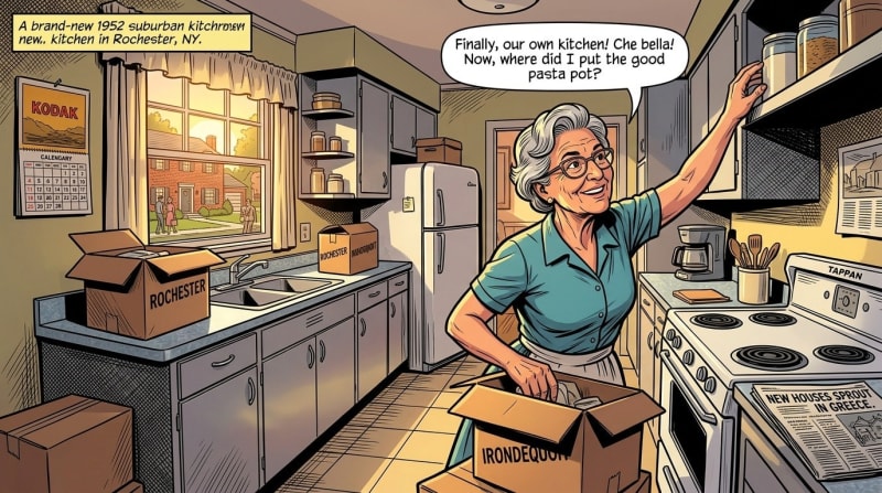
Irondequoit
Irondequoit occupies one of the most unusual geographic positions of any suburb in Monroe County. Bounded by the City of Rochester to the south and west, Irondequoit Bay to the east, and Lake Ontario to the north, the town is essentially a peninsula — and its character reflects that containment.
The name is of Iroquois origin and means "where the land meets the water," which is precisely accurate. Irondequoit Bay is one of the most beautiful stretches of water in the region, a long narrow inlet from Lake Ontario that provides kayaking, fishing, and waterfront living within minutes of downtown Rochester. The bay and lake define the town in ways that no other suburb shares.
With a population of 50,438, Irondequoit is the largest suburb by population that is not the Town of Greece (U.S. Census Bureau, American Community Survey 5-Year Estimates, 2023). Its median household income is $76,871, essentially at the Monroe County median, making it a solidly middle-class community. Median home values run approximately $169,000, the most affordable of the inner-ring suburbs (DataUSA, Irondequoit NY, 2023). The median age is 43.6 — older than the city's neighborhoods but reflecting a stable, established community with deep roots.
Those roots run Italian. The strongest ancestry in Irondequoit is Italian at 24.1% of residents — a legacy of the mid-20th century migration of Italian-American families from the city's northeast quadrant into the then-new suburb (City-Data, Irondequoit NY, 2024). Irondequoit was the first suburb in Monroe County to see substantial population growth after World War II, growing from 23,376 residents in 1940 to 55,337 in 1960 — a 136% increase in just twenty years (Wikipedia, Irondequoit New York, 2025).
The town also has a piece of civil rights history worth knowing: in 1965, Irondequoit participated in the first totally voluntary school desegregation program in U.S. history, the Urban-Suburban Interdistrict Transfer Program, which still operates today (Wikipedia, Irondequoit New York, 2025).
Irondequoit has Durand Eastman Park on the lake — a large, wild park with beaches, trails through old growth forest, and some of the most beautiful shoreline in the region. Seabreeze Amusement Park, one of the oldest amusement parks in the country, has been bringing Rochester families to the lake since 1879.
Fairport
If you want to understand what a suburb looks like when it commits fully to its own identity and refuses to let commerce or highway planning erase it, spend a Friday evening in Fairport.
The village — population approximately 5,000, within the larger Town of Perinton — sits on the Erie Canal about eight miles east of Rochester, and it has built its entire civic life around that fact. Main Street crosses the canal on a lift bridge built in 1914, an irregular decagon (no two angles the same, no square corners) that still operates today, rising vertically to let tall boats pass underneath. The sight of Main Street traffic stopping while a canal boat glides underneath remains one of the region's most charming everyday spectacles (Erie Canalway National Heritage Corridor, Village to Village).
The canal is not just a historic artifact in Fairport — it is a working recreational waterway. More than 600 canal boats stop in Fairport each year. The towpath trail is heavily used by cyclists and walkers. Kayaks can be rented and launched from within the village. The Colonial Belle operates three-hour narrated lock cruises west toward Pittsford and Lock 32 Canal Park.
The commercial district has been transformed through adaptive reuse of industrial buildings that once served the canal trade. The Cannery — the former American Can Company factory that operated from 1909 to 1993 — is now home to athletic facilities, offices, multiple restaurants, breweries, a distillery (Iron Smoke Whiskey), and entertainment venues (Fairport Office of Community and Economic Development). This is exactly the kind of adaptive reuse that creates community rather than erasing it: old buildings, new uses, human scale preserved.
Fairport has pickleball courts, several gyms, a good range of bars and restaurants, and a nightlife scene that draws young people from across the east side. It accommodates an unusually wide demographic range — young couples, families, empty nesters — and does so without the stratification that afflicts some of the more affluent suburbs.
The Canal Days Festival, held every June, has been a community tradition for nearly fifty years. It draws up to 100,000 visitors over the festival weekend — a staggering number for a village of 5,000 — and reflects the degree to which Fairport has made its canal heritage a genuine community asset rather than a historical footnote (Fairport Canal Days, 2026).
Fairport's motto should probably be: know what you have and build around it.

Penfield
Penfield's motto is "A Town of Planned Progress," and the planning is real. The progress, however, depends on what you think you're progressing toward.
The town was incorporated in 1810, named for Daniel Penfield, a Revolutionary War veteran who purchased the land in 1795 and established mills along the falls of Irondequoit Creek to attract settlers. The creek drops 90 feet through Penfield, and those early mill sites shaped the town's original geography. The Daisy Flour Mill on Blossom Road, built in 1848, operated until 1972 and is now a Penfield landmark listed on the National Register of Historic Places — the only remaining mill structure in the town (Town of Penfield, Town History).
The original business center — the Four Corners, where Five Mile Line Road crossed Penfield Road — was never incorporated as a village, which meant it never developed the institutional bones to resist suburban sprawl when sprawl arrived in the 1950s and 1960s. The population went from around 3,000 in 1940 to 23,732 in 1970 — and the infrastructure that came with that growth was suburban rather than village in character (Town of Penfield, Town History).
Today Penfield has a population of approximately 39,000, well-regarded schools (Penfield Central School District), abundant parks, and a heavily wooded character that gives it a quieter, more spacious feel than the inner-ring suburbs. Many residents appreciate the balance between east-side suburban convenience and a somewhat more rural atmosphere as you move toward Wayne County. Median home prices are competitive with Pittsford and Brighton (Niche, Penfield Monroe NY, 2024).
Penfield Road — the main commercial corridor — was widened to four lanes in the decades following suburban development, a decision that significantly diminished whatever village character the town center might have developed. The wider road made the commercial strip more car-accessible and less walkable, draining life from what could have been a genuine town center. Lou Gramm, lead singer of Foreigner, grew up in Penfield — a reminder that even suburbs without strong central gathering places produce remarkable people.
Penfield is a genuinely pleasant place to live. Its residents cite its safety, its schools, its parks, and its sense of community with real warmth. But for those who want a suburb with a strong physical center — a Main Street, a village square, a place to walk to — Penfield's planning history has made that harder to find.
Webster
Webster is a suburb that is caught between two versions of itself, and the tension is visible from the road.
The village of Webster has a historic downtown. It is small and somewhat worn, but it has bones — a modest but genuine Main Street with buildings that reflect the agricultural community the village once was. Route 250 runs through the center of the village, and if you slow down and look, you can see what Webster might have been with different choices in the postwar decades.
What happened instead was Route 104. The four-lane expressway was built along the northern part of the village as the town experienced rapid postwar growth — population more than doubled between 1950 and 1960 — and Xerox's major investments in office, research, and manufacturing facilities in the Webster area accelerated that growth dramatically (Wikipedia, Webster Village New York, 2025). Development followed the highway, clustering retail and commercial activity along the 104 corridor. A mall was built almost directly adjacent to the historic downtown, and the energy that might have sustained the original village center migrated north toward the highway.
The result is a town with approximately 42,000 residents in the broader municipality, a median household income of $66,584, and strong schools, but without a strong physical center to hold it together (DataUSA, Webster NY, 2023). Residents tend to cite the town's proximity to Lake Ontario and Irondequoit Bay — the lake access along the 590 corridor and at Webster Park is genuine and beautiful — and its relative quiet as the primary appeals. The schools are well-regarded and the housing is affordable relative to Pittsford and Brighton.
Webster works well as a suburb. It just works less well as a place with a clear identity, which is not a personal failing of its residents — who by most accounts form strong neighborhood communities — but a consequence of planning decisions made seventy years ago that prioritized highway access over village coherence.

Greece
Greece is Monroe County's largest town, with a population of approximately 96,926 — larger than many small cities, but organized in a way that makes that scale feel diffuse rather than energizing (U.S. Census Bureau, American Community Survey 5-Year Estimates, 2023).
The town has genuine history. The Erie Canal passes through Greece — it was completed through this section by 1822 — and the hamlet of South Greece (now Henpeck Park) was established to serve canal travelers and workers. Some of the European stonemasons who came to build the canal stayed and built the cobblestone houses that are somewhat unique to Central and Western New York, three of which still stand in Greece as of 2024 (Wikipedia, Greece New York, 2025).
That history has been largely overwhelmed by the commercial development that defines the town today. Ridgeway Avenue and the area around the Greece Ridge Mall have been built out with a density of strip commercial development that makes it difficult to identify any center of gravity. The mall itself, the surrounding retail corridors, and the highway-oriented development along Route 104 create a landscape that is convenient in the way that strip malls are always convenient, and communal in the way that strip malls are never communal.
The median household income in Greece is $77,278, slightly above the Monroe County median, and the poverty rate is 9.1% (U.S. Census Bureau, American Community Survey 5-Year Estimates, 2023). The town's housing is affordable relative to the east-side suburbs, with median home values around $173,752. Greece attracts residents who prioritize affordability and highway access — it sits along Route 390 and 104, providing easy connections to the Thruway and downtown — and its residents speak warmly of their neighborhood communities even where the town's physical structure makes those communities harder to see from the outside.
Greece does have lake access — Braddock Bay and the shoreline of Lake Ontario along the northern edge of the town — and the birding at Braddock Bay is nationally recognized. For those who value the lake without the premium prices of the east-side suburbs, Greece's north neighborhoods offer something real.
Which Neighborhood Is Right for You?

Which Neighborhood Is Right for You?
Rochester's neighborhoods and suburbs are not interchangeable, and the right choice depends entirely on what you are looking for. Here is an honest summary to help orient the decision.
If you want the fullest urban experience — walkable, dense, restaurant-rich, with a strong neighborhood identity and the energy of a real city — look at Park Avenue, the ABC Streets, South Wedge, Pearl-Meigs-Monroe, and NOTA. These are the neighborhoods that feel most alive on a random Tuesday evening.
If you want city character with more quiet — historic architecture, strong community associations, and access to parks without the commercial bustle — look at Highland Park, Upper Monroe, Browncroft, Corn Hill, and East Avenue.
If you want a suburb with a genuine village feel — walkable center, historic architecture, canal access, and a clear community identity — Pittsford and Fairport are in a class by themselves in the Rochester region.
If you want suburban space with good schools and strong communities — without necessarily prioritizing walkability or a village center — Brighton, Penfield, and Irondequoit all deliver, each with its own character. Brighton skews academic and diverse; Penfield skews spacious and conservative; Irondequoit skews middle-class, Italian-heritage, and lake-oriented.
If you want affordability above everything else — Greece and Webster offer the most accessible price points among the suburbs, with good schools and functional suburban infrastructure, though with the trade-offs in town-center character described above.
If you want the lake — Charlotte from the city side, or Irondequoit, Webster, and Greece from the suburban side, each give you different relationships with Lake Ontario. Charlotte is the most raw and authentic; Irondequoit and Webster offer more polished lake-access communities.
The best neighborhoods in any city are the ones where people feel genuinely invited in — where community is not a marketing concept but a daily practice, where the streets are designed for encounter rather than avoidance, and where a new resident is welcomed not as a consumer of the neighborhood's amenities but as a member of something ongoing. Rochester has many neighborhoods that operate this way. The ones that have survived longest, and thrived most fully, are the ones that have protected their human scale against the forces — highways, strip malls, highway-adjacent retail — that have worked against it for seventy years.
Rochester is putting itself back together. The best way to be part of that is to find the neighborhood that fits you and show up for it.
Statistics in this guide are drawn from the U.S. Census Bureau American Community Survey 5-Year Estimates (2023), the U.S. Census Bureau Population Estimates Program (2024), DataUSA, Point2Homes, NeighborhoodScout, Census Reporter, City-Data.com, Niche, Homes.com, the City of Rochester neighborhood profiles, Wikipedia, and various neighborhood association sources. All figures reflect the most current available data at time of publication and should be verified independently for real estate decisions.
Content ID: Mwbm6jl5TuWbYCVucghqS4Qz
See an error? Tell us.
Comments
Share with the Community
Keep Reading
Rochester Just Became America's Laser Research Hub — What the STELLAR Engine Means for Our City
Roc City Skatepark Phase 2 Is Opening This October — Rochester Is About to Have the Biggest Concrete Skatepark in New York
Rochester Is About to Rewrite Its Zoning Code — Here Is What Changes and What It Means for Your Neighborhood